Bathing water quality in Gozo and Comino, Malta
Gozo and Comino has 23 official bathing waters in the EEA dataset for the 2025 season — all coastal. 91.3% were classified Excellent — 2.8 points above the 88.5% across Malta — and 0 were Poor. 21 sites have been Excellent in every season from 2015 to 2025.

official bathing waters
Excellent in 2025
Poor in 2025
Map of official bathing waters in Gozo and Comino
Most consistent Excellent sites
21 sites were Excellent in all eleven seasons. Ordered by the length of the unbroken Excellent run ending in 2025.
- BLUE LAGOON 11 seasons
- DWEJRA INLAND SEA 11 seasons
- IL-BAJJA TA DAHLET QORROT 11 seasons
- IL-BAJJA TA HONDOQ IR-RUMMIEN 11 seasons
- IL-BAJJA TA MARSALFORN GHAR QAWQLA 11 seasons
- IL-BAJJA TA MARSALFORN IL-PALLETTA 11 seasons
- IL-BAJJA TA MARSALFORN LH SIDE OF BAY 11 seasons
- IL-BAJJA TA MARSALFORN PONTA SANTA MARIJA 11 seasons
- IL-BAJJA TA MGARR IX-XINI 11 seasons
- IL-BAJJA TA MGARR IX-XINI PRIVATE BEACH 11 seasons
- IL-BAJJA TA SAN BLAS 11 seasons
- IL-BAJJA TA SAN NIKLAW 11 seasons
- IL-BAJJA TA SANTA MARIJA 11 seasons
- IL-BAJJA TAL-QBAJJAR 11 seasons
- IL-BAJJA TAX-XLENDI IL-KANTRA 11 seasons
- IL-BAJJA TAX-XLENDI OPP GHAR TA KAROLINA 11 seasons
- IL-BAJJA TAX-XWEJNI 11 seasons
- IL-BAJJA TAZ-ZEWWIEQA 11 seasons
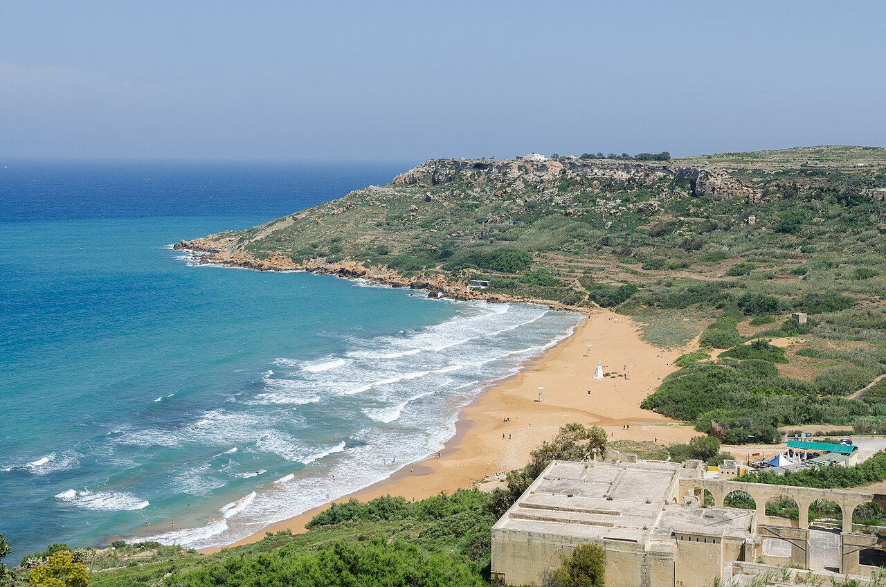
- IR-RAMLA L-HAMRA LEFT SIDE OF BAY 11 seasons
- IR-RAMLA L-HAMRA RIGHT SIDE OF BAY 11 seasons
- XATT L-AHMAR 11 seasons
Rated Poor in 2025
None of the 23 official bathing waters in Gozo and Comino was classified Poor in 2025.
Changes from 2024 to 2025
Improved (0)
None.
Declined (2)
- IL-BAJJA TAX-XLENDI LH SIDE OF BAY Excellent → Good
- IL-BAJJA TAX-XLENDI RH SIDE OF BAY Excellent → Good
How Gozo and Comino rated since 2015
Counts for the sites in today’s 2025 inventory; the Excellent share is calculated over classified sites only.
| Season | Classified | Excellent | Excellent share | Poor |
|---|---|---|---|---|
| 2025 | 23 | 21 | 91.3% | 0 |
| 2024 | 23 | 23 | 100% | 0 |
| 2023 | 23 | 23 | 100% | 0 |
| 2022 | 23 | 23 | 100% | 0 |
| 2021 | 23 | 23 | 100% | 0 |
| 2020 | 23 | 23 | 100% | 0 |
| 2019 | 23 | 23 | 100% | 0 |
| 2018 | 23 | 22 | 95.7% | 0 |
| 2017 | 23 | 22 | 95.7% | 0 |
| 2016 | 23 | 22 | 95.7% | 0 |
| 2015 | 23 | 21 | 91.3% | 0 |
Places with the most bathing waters in Gozo and Comino
Each site is matched to its nearest named place (GeoNames, within 8 km in a straight line), so beaches of one resort or lake shore can be compared together. Select a place to show only its sites in the full list.
| Place | Sites | Excellent | Poor |
|---|---|---|---|
| Żebbuġ | 6 | 6 (100%) | 0 |
| Qala | 5 | 5 (100%) | 0 |
| Kerċem | 4 | 2 (50%) | 0 |
| Għajnsielem | 3 | 3 (100%) | 0 |
| Xagħra | 2 | 2 (100%) | 0 |
All 23 official bathing waters in Gozo and Comino
Grouped by water type, alphabetical within each group. Open a site for its 2015–2025 history, nearby alternatives, weather forecast and the national profile link.
Download all 23 sites as CSV (classes 2015–2025, coordinates, nearest place; EEA data, CC BY 4.0)
Coastal 23 sites · 91.3% Excellent
- BLUE LAGOON · Qala Excellent Excellent 11 seasons in a row
- DWEJRA INLAND SEA · San Lawrenz Excellent Excellent 11 seasons in a row
- IL-BAJJA TA DAHLET QORROT · Qala Excellent Excellent 11 seasons in a row
- IL-BAJJA TA HONDOQ IR-RUMMIEN · Qala Excellent Excellent 11 seasons in a row
- IL-BAJJA TA MARSALFORN GHAR QAWQLA · Żebbuġ Excellent Excellent 11 seasons in a row
- IL-BAJJA TA MARSALFORN IL-PALLETTA · Żebbuġ Excellent Excellent 11 seasons in a row
- IL-BAJJA TA MARSALFORN LH SIDE OF BAY · Żebbuġ Excellent Excellent 11 seasons in a row
- IL-BAJJA TA MARSALFORN PONTA SANTA MARIJA · Żebbuġ Excellent Excellent 11 seasons in a row
- IL-BAJJA TA MGARR IX-XINI · Għajnsielem Excellent Excellent 11 seasons in a row
- IL-BAJJA TA MGARR IX-XINI PRIVATE BEACH · Għajnsielem Excellent Excellent 11 seasons in a row
- IL-BAJJA TA SAN BLAS · Nadur Excellent Excellent 11 seasons in a row
- IL-BAJJA TA SAN NIKLAW · Qala Excellent Excellent 11 seasons in a row
- IL-BAJJA TA SANTA MARIJA · Qala Excellent Excellent 11 seasons in a row
- IL-BAJJA TAL-QBAJJAR · Żebbuġ Excellent Excellent 11 seasons in a row
- IL-BAJJA TAX-XLENDI IL-KANTRA · Kerċem Excellent Excellent 11 seasons in a row
- IL-BAJJA TAX-XLENDI LH SIDE OF BAY · Kerċem Good Excellent → Good since 2024
- IL-BAJJA TAX-XLENDI OPP GHAR TA KAROLINA · Kerċem Excellent Excellent 11 seasons in a row
- IL-BAJJA TAX-XLENDI RH SIDE OF BAY · Kerċem Good Excellent → Good since 2024
- IL-BAJJA TAX-XWEJNI · Żebbuġ Excellent Excellent 11 seasons in a row
- IL-BAJJA TAZ-ZEWWIEQA · Mġarr Excellent Excellent 11 seasons in a row
- IR-RAMLA L-HAMRA LEFT SIDE OF BAY · Xagħra Excellent Excellent 11 seasons in a row
- IR-RAMLA L-HAMRA RIGHT SIDE OF BAY · Xagħra Excellent Excellent 11 seasons in a row
- XATT L-AHMAR · Għajnsielem Excellent Excellent 11 seasons in a row
Compared with other island regions in Malta
| # | Island region | Sites | Excellent | Poor |
|---|---|---|---|---|
| 1 | Gozo and Comino | 23 | 91.3% | 0 |
| 2 | Malta | 64 | 87.5% | 0 |
Island regions with at least 15 official bathing waters. Size, water type and how densely sites are designated differ, so the table is context rather than a verdict.
Quick answers
- How many bathing waters in Gozo and Comino were rated Excellent in 2025?
- 21 of 23 (91.3%) in the official EEA 2025 classification; 2 were Good, 0 Sufficient and 0 Poor. That ranks Gozo and Comino 1 of 2 Malta island regions by Excellent share.
- Which beaches in Gozo and Comino have the best long-term record?
- 21 sites were Excellent in every season from 2015 to 2025, for example BLUE LAGOON, DWEJRA INLAND SEA, IL-BAJJA TA DAHLET QORROT. See the ranking.
- Which places in Gozo and Comino have the most official bathing waters?
- Żebbuġ (6, 100% Excellent), Qala (5, 100% Excellent), Kerċem (4, 50% Excellent). See the place table; places are the nearest named settlement to each site.
- Were any bathing waters in Gozo and Comino rated Poor?
- No. None was classified Poor in 2025.
- Where do I check whether swimming is allowed today?
- On Bathing Water Programme (Environmental Health Directorate, Superintendence of Public Health). Temporary bans, pollution alerts and closures are published there and on signs at the water, not in the annual EEA class.
Malta overview · All island regions of Malta · Bathing season dates
Sources and method
Bathing-water records: European Environment Agency (EEA), data and coordinates reported by Malta, licensed CC BY 4.0. Region and area boundaries: Eurostat NUTS 2024 (© EuroGeographics for the administrative boundaries). Place names: GeoNames (CC BY 4.0). A site belongs to the area that contains its reported coordinates; a site up to 10 km off the generalised coastline is placed in the nearest area of Malta. Counts, shares and rankings are calculated by BathingWaterFinder from the official records.